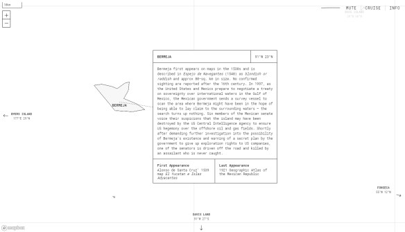
The term “phantom island” refers to an island that appeared on historical maps (sometimes for many years) even though it doesn’t exist. Most phantom islands emerged from the era of European sea exploration and colonization. Phantom Islands – A Sonic Atlas is a project that pairs original sound recordings with 27 phantom islands. Each of these islands are placed according to their coordinates on historical maps. Visitors can explore these individual islands by either taking a “cruise” or by navigating with their cursor. As one visits each island, they will hear a unique soundscape and can read about the island’s history, including the date of the island’s first and last appearance in print. Check it out!