So true! Click for more GIS t-shirts and hoodies.


So true! Click for more GIS t-shirts and hoodies.
Ah yes, welcome to the bleeding edge! ArcGIS 10.6 is here in prerelease form. If you have current maintenance, then you have access to the software from my.esri.com.
If you are considering installing ArcGIS Desktop 10.6, make sure the check out the Quick Start Guide, Release Notes, and What’s New for 10.6.
Make sure to read the release notes. You will find that for ArcGIS Enterprise, upgrading to Prerelease from earlier versions is not supported. You are required to do a new installation.
I also found in the What’s New doc that at 10.6 you can now use the PostGIS geography type to store spatial data in PostgreSQL databases and geodatabases in PostgreSQL. Also PostgreSQL 9.3 is not supported, so upgrade to 9.4.8 or 9.5.3!
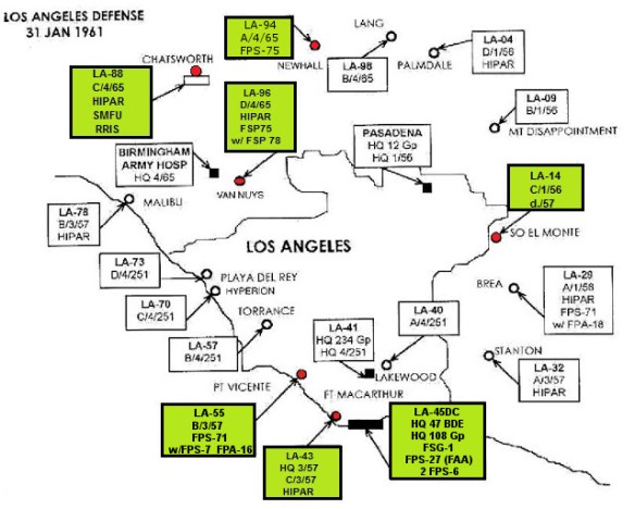
Did you know during the cold war that Los Angeles was surrounded by nuclear weapons? Or with the help of a newspaper, the city was mocked bombed by a squadron of planes? We even had the Soviet National Convention here!
Check out all this and more at the Cold War LA site. Cold War LA is a digital project that serves as an educational resource about the social, cultural, and political aspects of the Cold War era in Los Angeles for students, educators, veterans, and hobbyists. And yes there are a few maps too!
If you use ArcGIS Online, ESRI now has “Locator Views” in their geocoders. Basically you can specify what types of locations or only within a specific country or area you want to geocode against. For example, maybe you are just geocoding US addresses, not the whole world. Or maybe you just need to geocode to airport 3-letter codes. Whatever you need, you can customize your geosearching and geocoding experience. Click below for more info.

If you are a librarian or someone that deals with a geospatial data repository, this might be for you.
Geo4LibCamp is a hands-on “unconference” meeting to share best-practices, solve common problems, and address technical issues with integrating geospatial data into a repository and associated services. The main event will be held at Stanford University on January 29-31, 2018 (Monday, Tuesday, and Wednesday), with optional working sessions on February 1-2 (Thursday and Friday).
Check out this article by National Geographic about mapping the urban bike utopias of the 1890s. At that time, the bicycle gave middle-class people more freedom to travel when and where they wanted. Cities today are striving to become the most “bikeable”.

Ah yes, I was at Costco this weekend and Christmas decorations are out … as well as Halloween and Thanksgiving! Insane right? What alternate universe am I in?
Anyway, checking the Christmas Clock, there are only 97 days left until Christmas! You better hurry and buy that perfect gift!
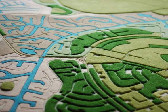
Here is one: Land Carpet Map Rugs! Yes, get that map in carpet form so your loved one can walk all over it.
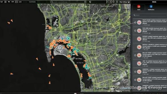
Check out how San Diego Harbor Police integrates GIS technology, video, and radar systems to keep people safe in the Port of San Diego.
I remember sitting at my desk at work that morning in 2001 watching what was going on in New York. The City’s cable access channel staff had their TV feeds going all day long.
I also remember how quiet it was in the sky when I got home that evening. That day the FAA closed all airspace and grounded all flights.
It went from this (9:30am EDT):

to this (after 12pm EDT):
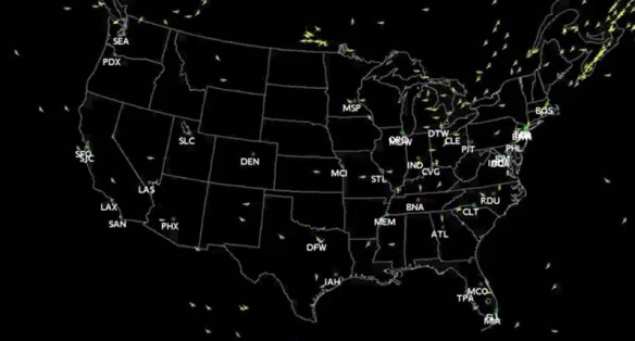
It was very quiet over the skies in SoCal on the 12th. Flights resumed on the 13th and 14th in tiers. By the 21st they were fully restored. Watch the video here. For more info on 9/11, click here.
ESRI has released three new ArcGIS Pro styles for Emergency Management, Local Government, and State Government industries for version 2.0. For example, the Local Government style contains symbols for election polling places, real estate transactions, community events, parks, damage assessment, right of way assets, non-emergency problem reports, catch basins, and fire hydrants.
Visit the ArcGIS Blog post for more info.
