ArcGIS 10.8 has been released and is now available for download from your account on my.esri.com. For what’s new in ArcMap and ArcCatalog, click here. For what’s new in ArcGIS Enterprise, click here.
ArcGIS 10.8 Released
Reply

ArcGIS 10.8 has been released and is now available for download from your account on my.esri.com. For what’s new in ArcMap and ArcCatalog, click here. For what’s new in ArcGIS Enterprise, click here.
The Geospatial Historian is “a tutorial-based open access textbook for historical scholars and digital humanists designed to teach practical digital mapping and GIS skills that are immediately useful to real research needs.” Under Lessons, you will find two series of GIS tutorials geared towards historical analysis and applications. The first series, which uses open-source software, is comprised of four lessons that the project team created for the Programming Historian. The second series contains five lessons that teach mapping, georeferencing, and other applications using ArcGIS. The site also offers a helpful list of resources for Finding Spatial Data, organized by data type and featuring data from around the world. Check it out!

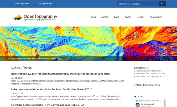
OpenTopography provides high-quality geographic data relating to earth science as well as a platform for researchers to share their own data. Based at the University of California, San Diego, OpenTopography is an ambitious project that “facilitates community access to high-resolution, Earth science-oriented, topography data, and related tools and resources,” and is funded through the National Science Foundation.
You can search or browse the project’s datasets via an interactive data map and a data catalog, both found under Data. Most of these datasets are available in Lidar point cloud format, and many are also available in other formats, such as raster or Google Earth. Check it out!
California has adopted a massive, interactive online database of location-based government data that includes over 1200 publicly available data sets from 25 state entities.
The California State Geoportal collects geospatial data from government agencies including housing, water, transportation and health information. The data is compatible with geolocation software and is designed to be shared, layered onto maps and analyzed.
The portal was designed by ESRI. Check it out!

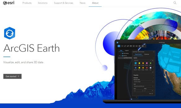
ESRI has released ArcGIS Earth version 1.10. With this release, users can now:
Check it out and download the free app.
ESRI released ArcGIS Pro 2.5 last week. You can download it from your ESRI account on my.esri.com.
Visit the ESRI blog about what’s new and watch the video below showing the new features in ArcGIS Pro 2.5.
On December 31, 2019, the World Health Organization (WHO) was informed of an outbreak of “pneumonia of unknown cause” detected in Wuhan City, Hubei Province, China – the seventh-largest city in China with 11 million residents. By January 23, there was over 800 cases of 2019-nCoV confirmed globally, including cases in at least 20 regions in China and nine countries/territories. As of this writing, there are now 17,485 confirmed cases and 362 deaths!
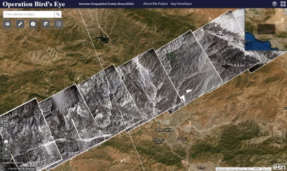
Operation Bird’s Eye is a photographic collection of nearly 400 overlapping aerial images which form a continuous strip spanning the United States from coast to coast. Beginning in Ventura, California and ending over Long Island, New York, these nine by nine inch prints capture a sliver of the American landscape as it looked in 1948. The images were captured during one continuous flight, and when joined together the physical prints stretch 192 feet, showing a slice of land 2,700 miles long.
The flight from which these images were captured took off from the Air Force Flight Test Center (now Edwards Air Force Base) in Muroc, California at 7:40 AM local time on September 1, 1948, first gaining altitude out over the Pacific Ocean before turning east. The plane was a Republic XR-12, an experimental aircraft of which only two were ever built. It was outfitted with K-17 cameras able to shoot a continuous roll of film up to 200 frames. The camera shot at 50 second intervals throughout the duration of the flight, at a constant altitude of 40,000 feet, resulting in a field of vision of around 130 square miles.
The purpose of the XR-12 was photo reconnaissance, and Operation Bird’s Eye was meant as a demonstration of its capabilities. The plane, able to fly high and fast enough to avoid conventional enemy aircraft and fighters, was essentially a flying photography laboratory, with the crew able to process film mid-flight. The Operation Bird’s Eye flight broke records as it crossed the continent, capturing the longest span of aerial photos ever accumulated in a single trip to that point. After 6 hours and 55 minutes, the crew landed at Mitchel Field in Garden City, New York on Long Island.
Click below to read more and check out the images!
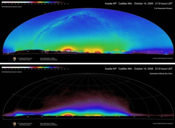
Check out this article about mapping resources that we do not see or hear, like natural sounds, dark night skies, and clean air. Click below to read.
The ArcGIS User Seminar is a free event that is designed to inspire and guide you to getting the most from your organization’s investment in ArcGIS products. Join ESRI for a full-day seminar with an afternoon workshop. Space is limited in the workshop. ESRI experts will teach users how to become more successful in their work by sharing solutions, reviewing new capabilities, discussing best practices, and building community.
An ArcGIS User Seminar will be offered on February 21 in Glendale. For more information and to register, click here.
