If you are interested in an online Master’s degree program in GIS, check out the latest posting on Geographical Perspectives for 2016. The Spatial Sciences Institute at USC made #1.
Top 10 Online Master’s Programs in GIS
Reply
If you are interested in an online Master’s degree program in GIS, check out the latest posting on Geographical Perspectives for 2016. The Spatial Sciences Institute at USC made #1.
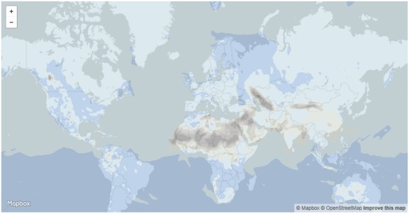
In the spirit of academic peer review, Guerrilla Cartography invites its global peer community to review the maps submitted to Water: An Atlas. Share your questions, thoughts, and impressions to improve their global cartographic movement.
Guerrilla Cartography is a loose band of cartographers, researchers, and designers intent on widely promoting the cartographic arts and facilitating an expansion of the art, methods, and thematic scope of cartography, through collaborative projects and disruptive publishing.
If you are an X-Files fan, then you will like this interactive map of every X-File location (real and fictitious).
Plume Air Report is a weather forecasting app for urban air pollution. The free app, developed by Plume Labs, tells you if it’s safe to run, bike, go out with your children or eat outside.
To do this, the company relies on thousands of pollution monitoring stations. The company aggregates the usual suspects, nitrogen dioxide (NO2), ozone (O3) and particulate matter (PM2.5 and PM10), and then hides all the complexity behind a simple index. The app covers over 150 cities around the world. Check it out!
Hexagon Geospatial has launched a global competition, IGNITE, to plan and build an innovative Hexagon Smart M.App, a cloud based dynamic information experience that transforms geospatial information into 360° business analytics and meaningful visualizations. The Hexagon Smart M.App provides the understanding that leads to world-changing solutions.
You may submit ideas in any of the six core challenge themes – Finance, Food, Safety, Infrastructure, Health, and Conservation.
IGNITE Challenge Phases:
1. Ideation Phase
2. Execution Phase
Timeline: The last date for registration for the ideation phase is May 1, 2016. Top 20 finalists from the ideation phase will then be selected for the execution phase where they will have approximately 3 months, until August 31, 2016, to build their Hexagon Smart M.App.
Prize Details: The top 3 finalists of the execution phase will be awarded cash prizes of $100K, $50K and $25K for 1st, 2nd and 3rd place winners. The remaining 17 finalists will each receive $5,000 prizes for their submissions.
Visit the IGNITE challenge page to find out more and to register as an innovator, either as an individual or as a team. No entry fee is required.
Boundless, a provider of open source geospatial software and services, recently announced the upcoming version of their OpenGeo Suite will support the output of vector tiles, including the popular open source Mapbox Vector Tiles (.mvt) format. The next version of OpenGeo Suite is expected to be released by the end of January, and will include an updated instance of GeoServer which supports output in vector tile formats. Click here for more info.
ESRI is hosting a Massive Open Online Course (MOOC) on building your own Geo Apps. They state:
You don’t have to be a software developer to build valuable geo-enabled apps that make your communities smarter and businesses more successful. This course will show you how to combine location and narrative in one application to better communicate and broadcast your story, create custom web applications that solve problems in your community, and build powerful native applications for iOS and Android devices without touching a piece of code. If you are a developer, you’ll be interested in Esri’s APIs, SDKs, and the buzzing GeoDev community.
The course includes:
You will be exposed to application templates and test drive Web AppBuilder and AppStudio. The free online course runs from February 3 to March 3, 2016. Check it out and sign up!
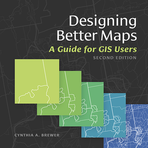
Designing Better Maps: A Guide for GIS Users, second edition, is a comprehensive guide to creating maps that communicate effectively. Author and cartographer Cynthia A. Brewer guides readers through the basics of good cartography, including layout design, scales, projections, color selection, font choices, and symbol placement. Designing Better Maps also describes the author’s ColorBrewer application, an online color selection tool. The second edition includes a new chapter on map publishing. The book is paperback and 260 pages.
Check out a recent review of the book here.
PostGIS version 2.2.1 was released today, which is a patch to version 2.2. The focus is on bugs, breakages, and performance issues. The release includes many fixes for topology.
![]()
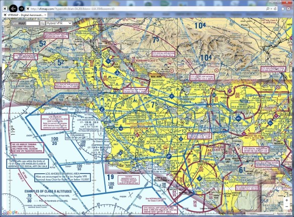
Happy New Year! For all of you that got remote controlled flying machines for Christmas, you might want to check out these apps that show you where you can and cannot fly your shiny new toy!
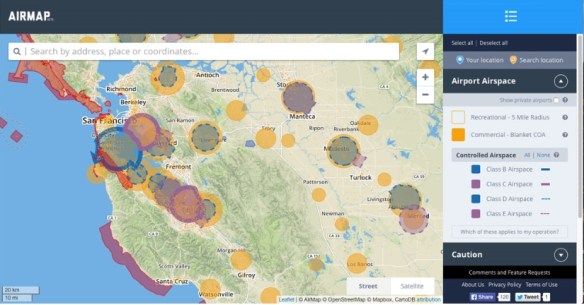
And if you are in the LA Basin area, please stay out of the controlled airspace when I am flying around … its a mess!