
So you want to add Google Maps to ArcMap or Pro? Impossible you say? Well here is an early Christmas present just for you … yes you can!
Before you proceed, think about why you would want a crowd sourced Google Maps basemap in your GIS anyway? There are better solutions today, like the basemaps provided by ESRI or even your own creations. For a government agency, replacing authoritative GIS data with crowd sourced data might not be a good idea.
Back in early 2014, I took a look at adding Google Maps to ArcMap using some available programs/add-ins, but all were disappointing. In late 2019 I did find a way to add Google Maps to QGIS 3. Building on that example, I was able to do the same for ArcMap and Pro, but in a round about way.
To do this, you need an ArcGIS Online account. Once logged in, open a new web map then click on Add and select “Add Layer from Web”. You will see this popup:

Select “A Tile Layer” from the pulldown menu. In the URL field enter “https://mt1.google.com/vt/lyrs=r&x={col}&y={row}&z={level}” and check the box “Use as Basemap”. In the Title field, enter “Google Maps” and in the Credits field enter “Google”. Your popup should look similar:

With everything filled in, click the ADD LAYER button. BAM! There is Google Maps!

Note the little “Google” credit in the lower right of the map. That is a good thing, always give credit where credit is due.
Zoom into the area that you want and then save your web map. Make sure you share your web map too (Share settings).
Now startup ArcMap or Pro and connect to your ArcGIS Online account. In ArcMap it is under File > Sign In. In Pro it is in the upper right hand corner and if you are not signed in it will display “Not signed in”. Once you login, you can add your web map.
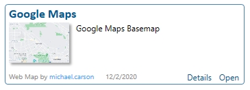
In ArcMap select File > ArcGIS Online and then in the search box type “google web map”. You should see your web map listed like mine:
Click the “Open” link and you should see it in ArcMap!

If you are using Pro, it would be in your Catalog window under the Portal tab.

Right click on it and choose “Add And Open”. And there you go!

If you prefer the satellite image or other images that Google provides, here is a list of Google Maps layers that you can add to ArcGIS Online then to ArcMap and Pro:
Google Maps: https://mt1.google.com/vt/lyrs=r&x={col}&y={row}&z={level}
Google Satellite: http://www.google.cn/maps/vt?lyrs=s@189&gl=cn&x={col}&y={row}&z={level}
Google Satellite Hybrid: https://mt1.google.com/vt/lyrs=y&x={col}&y={row}&z={level}
Google Terrain: https://mt1.google.com/vt/lyrs=p&x={col}&y={row}&z={level}
Google Roads: https://mt1.google.com/vt/lyrs=h&x={col}&y={row}&z={level}
You could even add each as a layer to one web map, then once added to ArcMap and Pro, you can turn each on or off as needed.
Enjoy and Merry Christmas 2020! -mike

that’s awesome Michael thank you!! and in addition, if you want to access street view in your Pro by simply clicking anywhere on the map then simply install this small file (dont worry, its safe) https://github.com/roemhildtg/arcgis-pro-addins/releases/tag/1.0.0
Pretty cool. Thanks!
Do you know if there’s a version of this that works in Pro 3x? This one is specific to v2.0
sadly, I am pretty sure this will still be violating the Google Terms of Service –
https://cloud.google.com/maps-platform/terms
specifically 3.2.3 Restrictions Against Misusing the Services.
“(e) No Use With Non-Google Maps. To avoid quality issues and/or brand confusion, Customer will not use the Google Maps Core Services with or near a non-Google Map in a Customer Application. For example, Customer will not (i) display or use Places content on a non-Google map, (ii) display Street View imagery and non-Google maps on the same screen, or (iii) link a Google Map to non-Google Maps content or a non-Google map.”
Another reason why to use your own authoritative content!
And the obligatory copyright lawyer shows up…unless google contacts me I’m not worrying about it. I’ve been using these for literally 10+ years. If they had a problem with it they could simply jscript it to check for browser req’s instead of leaving it exposed. It’s a non-issue.
I see… so you run red lights – because its ‘technically’ possible? Dont worry about it, cause you haven’t been caught for literally 10 years. No ethics in this one…
Puuhhhlease! you’re going to lecture me on ethics in regard to google?? My how the GIS world has come full circle to supporting mega corps. Sad. Anyway, like I said it’s a non issue. Use it…it’s wonderful!!
You can skip the online part of your instructions in ArcGIS Pro. Select “Data from path” in the “Add Data” drop down.
Is there a way to have the spatiotemporal Google datasets on Arcpro, Where i can actually skepped through the years right on ArcGIS pro
I am also interested in this!
This functionality no longer exists with ESRI’s “new” web map viewer. It still works with the old web map viewer.
It works in the new viewer too. Go to +Add, Choose “Tile Layer”, and paste in the links above, then choose “Use as Basemap”.
Could you please give more detail? Where in “+Add” do you find this?
Upper left of the new map viewer, the plus sign…hit that. Wish I could past a screenshot in here, but I just verified it’s still working.
This article was so helpful!! I was looking for the Google Basemap links and it led me to this (I needed these links!). I will add, that I created an individual Web Map for each service as a Basemap within the Web Map (not one map with all services as layers) and then followed ESRI’s guidance to get it to populate in the Basemap Gallery, rather than going to the portal content in Pro or ArcMap. However, of note, I am an administrator who can update our Portal or AGOL instance to populate these in the Basemap Gallery. Link for ESRI guidance: https://www.esri.com/arcgis-blog/products/arcgis-online/mapping/custom-basemap-gallery/
Is there an update to the google satellite link? I noticed that some areas have not been updated yet. this will be much appreciated.
Hi. Have you found a solution?
Thank you for your post, imagery is way better than what ESRI has available!
that is a blanket statement that isn’t quite true. ESRI Clarity Imagery is sometimes better than googles. just as Bing is better than either – depending where you are talking about
Is there a HTTPS for this link?
Google Satellite: http://www.google.cn/maps/vt?lyrs=s@189&gl=cn&x={col}&y={row}&z={level}
I got satellite to work with this link
“https://mt1.google.com/maps/vt/lyrs=s@189&gl=cn&x={col}&y={row}&z={level}”
Hope it works for you too!
Hello
It is possible Google Traffic layer?
Noticed the google satellite link is wrong (or at least didn’t work for me). I had success using this link instead “https://mt1.google.com/maps/vt/lyrs=s@189&gl=cn&x={col}&y={row}&z={level}”
Yep same here, but all of the mt.google links are working.
MANY THANKS!!
I still use this like every day!
Is there a way to turn off some of the layers in the google map before uploading to ArcGIS?
I do not think you can.