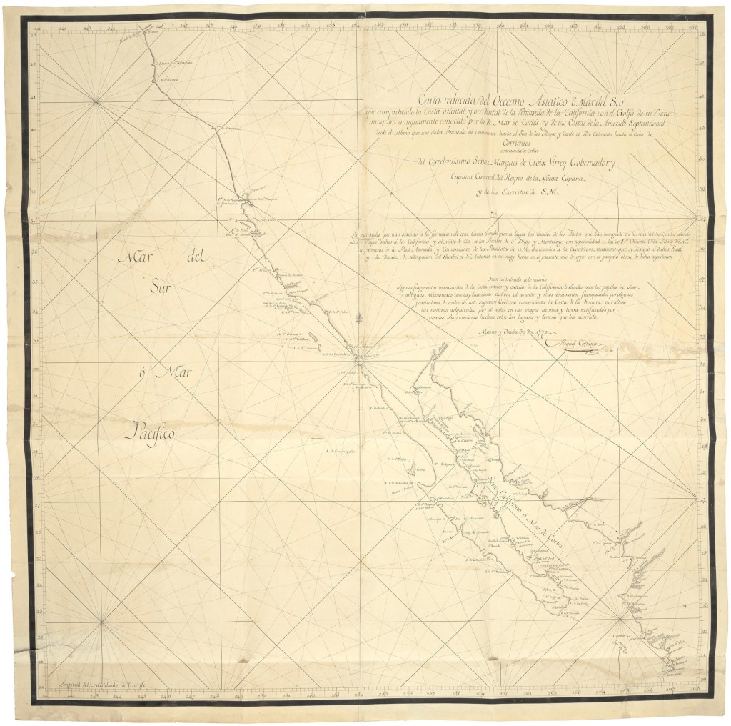
If you have some cash to spend, like $600,000 to $800,000, you too could own this rare map of California! COSTANSÓ, MIGUEL DE. 1741-1814: Original Manuscript Map of Coastal California Signed (“Miguel de Costansó”).
Costansó was the engineer for the Portola Expedition, creating the first land based maps of the California coastline, and discovering and mapping the port of San Francisco for the first time. There are only 4 copies that still exist, and you can own one of them! Check it out, and good luck on your bid!