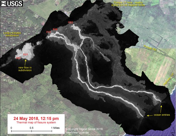
With all that is going on in Hawaii, the USGS is keeping up by mapping the fissure systems and lava flows of the eruption at Kilauea. They also have been taking thermal images so you can really see where the lava is flowing. Check it out!

With all that is going on in Hawaii, the USGS is keeping up by mapping the fissure systems and lava flows of the eruption at Kilauea. They also have been taking thermal images so you can really see where the lava is flowing. Check it out!

What happens when the lava enters the land? Does the land owner get more land?