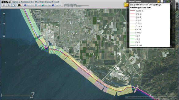
The USGS Coastal and Marine Geology Program (CMGP) National Assessment of Shoreline Change Web Mapping Application provides a national map view of short and long term shoreline change evaluations, and historical and modern shorelines. This map includes data layers compiled in support of the U.S. Geological Survey’s (USGS) National Assessment of Shoreline Change Program.
The default map view shows the long-term shoreline change rate within the continental U.S.. Within the Web Mapping Application, data layers have been grouped within category headings. Clicking the appropriate data folder will expand or collapse the folder allowing the individual data layers to be displayed. Data layers may be turned off or on by selecting the visible button beside the layer name. The map view will automatically update. A complete description of the available data layers and links to download the data may be found in the GIS Data Catalog under the More Info pulldown menu.