The US Geological Survey (USGS) and the Association of American State Geologists (AASG) have worked together to build the National Geologic Map Database (NGMDB). The NGMDB is mandated to be a standardized, “national archive” of geoscience information (maps and reports, both published and unpublished), made available to the public to support decision-making, research, and other needs. Its website opened in 1996, and it currently serves about 60,000 users each month, who make about 220,000 visits.
The principal sections of the NGMDB are:
- The Geoscience Map Catalog – Contains citations and Web links to >100,000 maps, stratigraphic charts, and reports by >630 publishers, many containing GIS data and map images.
- The US Geologic Names Lexicon (Geolex) – The standard reference for the Nation’s stratigraphic nomenclature.
- Standards – Cartographic, database design, science terminology, and data-exchange standards whose development was led by, or assisted by, the NGMDB project.
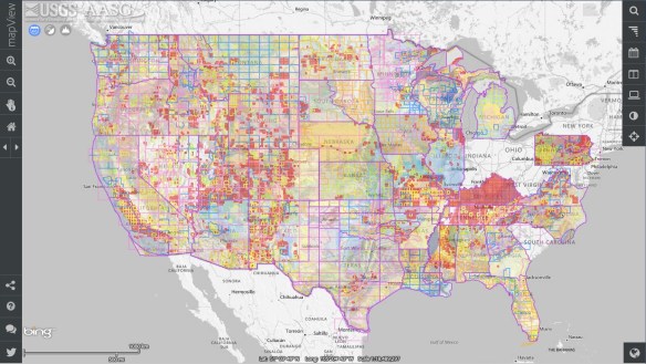
- Interactive map viewers – Two new features were added to the site: (a) “mapView”, which provides a mosaicked view of geologic maps as a new front-end to the NGMDB’s Map Catalog, and (b) topoView, which enables users to quickly search and browse the USGS Historical Topographic Map Collection.
Check the site out and give it a spin!