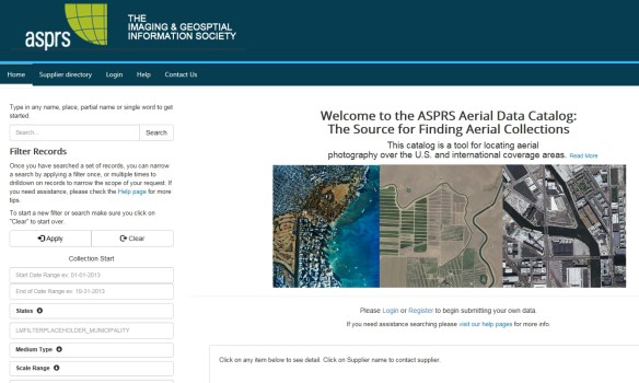
The American Society of Photogrammetry and Remote Sensing (ASPRS) has a new tool and is provided as a free service to the communities that utilize aerial photography. The tool is called the ASPRS Aerial Data Catalog and is a means to locate aerial photography from private companies, universities, states, NGOs, and federal sources. The catalog contains metadata allowing users to determine if coverage exists over an area of interest. The acquisition date, film type, sensor type, and scale are also provided along with the supplier contact information.
Also, if you have a collection of aerial photography, you can contribute to the catalog so others can find out about it. The tool can serve as an additional marketing source or possibly the only means you may have to advertise your holdings. Again, the service is free and to contribute simply register to fill in what is known about your collections.
This tool has been needed to shine light on the millions of frames of aerial photography that are essentially unknown. Check it out!