
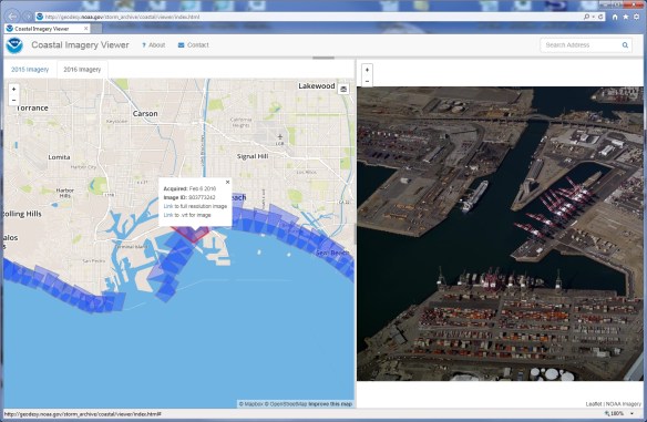
Check out the NOAA Coastal Imagery Viewer. The latest for the West Coast is Feb 6-9, 2016. The imagery was acquired to satisfy a wide range of integrated Ocean and Coastal Mapping (IOCM) requirements, such as emergency response and coastal zone management.
The data is considered public domain and you are encouraged to share with other interested parties. Click below to check out the app.
You can also do a bulk download of the data: https://coast.noaa.gov/htdata/NGS_oblique/NGSOblique_2016/2016obWestCoast_Imagery.tar
