
This week the US Energy Information Agency announced the availability of a new mapping tool that details the flood risk faced by our existing energy infrastructure. The map has icons located on sites like distribution terminals and power plants and allows users to overlay the existing flood risk on those sites. The clear message is that a lot of our infrastructure is already at risk.
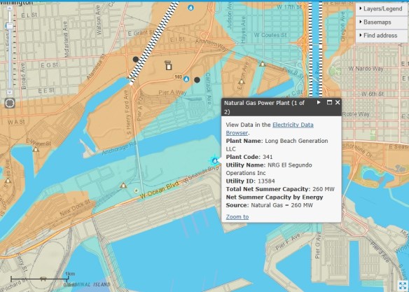
Flood hazard information from FEMA has been combined with EIA’s energy infrastructure layers as a tool to help state, county, city, and private sector planners assess which key energy infrastructure assets are vulnerable to rising sea levels, storm surges, and flash flooding.
