Check out this fire app built with ArcGIS Online, Experience Builder, and publicly available data.
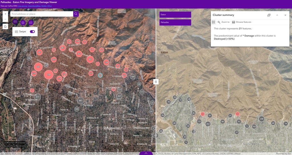
It combines CAL FIRE’s Damage Inspection (DINS) layers, Maxar imagery from NOAA & OpenAerialMap, dynamic charts that summarize DINS totals, historic structures in the Palisades area from Historic Places LA, and a link in the damage points pop-up to pre-fire Google Street View imagery.
More from the builder of the app here.

Here’s another app built for the City of Pasadena residents to view properties based on tag types (red, yellow, green), along with who to contact to check on the status of the case.
https://cityofpasadena.net/propertydamagecases