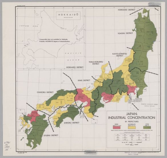
The Office of Strategic Services was formed in June 1942 in response to the entry of the United States into World War II. This was a time of codification of efforts around the collection of intelligence information in order to more effectively understand and respond to the events of the day. This effort brought together a number of experts, many from academia including a large number of cartographers. These cartographers created maps on demand that either stood alone or were part of reports. The maps were eventually distributed through the Federal Depository Library Program to libraries throughout the United States. The best estimate is that 5,753 unique maps were produced of which Stanford Libraries holds over 700.
Check out the new exhibit of maps by clicking below.