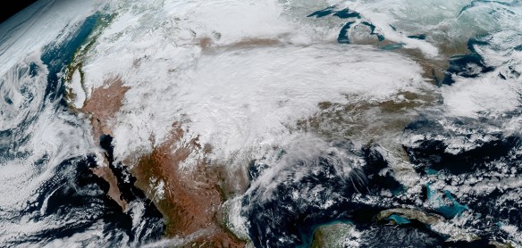
The National Oceanic and Atmospheric Administration (NOAA) has released the first image taken by Harris Corporation’s Advanced Baseline Imager (ABI) onboard their next-generation weather satellite. The image taken from the Geostationary Operational Environmental Satellite-16 (GOES-16) is of Earth’s full western hemisphere with detailed cloud and water features.
The Harris ABI is a high-resolution digital camera with image resolution of one-tenth of a square mile, or four times better than current imagers. Additional filters, or spectral bands, on ABI will detect more information about volcanic ash, dust, clouds, winds, fires, rainfall rate, and hurricane intensity than previous generations of geostationary weather satellites. Critical information about severe weather events can come as fast as 30 seconds, five times faster than previous technology.
Images will be downloaded and processed by a ground system, which controls the weather satellite and all of its six major instruments, including ABI. The ground system will also process the significant increase in new data, producing 1.75 terabytes of data per day for the National Weather Service and other users. In only three-and-a-half years, ABI data production will equal the total data production from 1975 through 2015 of all prior GOES imager and sounder data combined.
For more info and to see other images, click below.