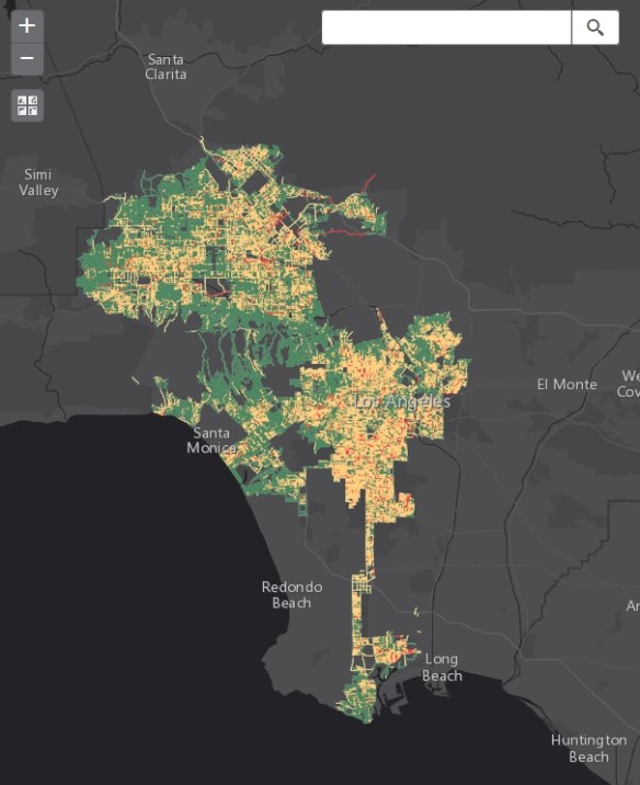
If you live in LA, then you might be interested in this interactive map. As part of the LA’s Clean Streets initiative, the City’s Bureau of Sanitation drove all of LA’s public streets and alleys, travelling over 22,000 miles, and gave each block a “cleanliness score” from 1-3, 1 being Clean, 2 Somewhat clean, and 3 Not clean. The scores are based on four factors: litter, weeds, bulky items, and illegal dumping. They plan on doing the same assessment every quarter. Check out the map and read an article about it here.