This is a great article about the geodetic reference frames that we use in our GIS. You might already be familiar with the ITRF. They also talk about sea level rise … did you know the west coast US sea level is actually falling? I did not.
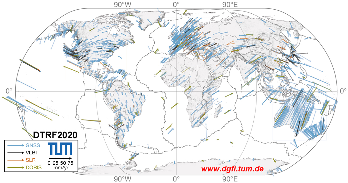

This is a great article about the geodetic reference frames that we use in our GIS. You might already be familiar with the ITRF. They also talk about sea level rise … did you know the west coast US sea level is actually falling? I did not.
