
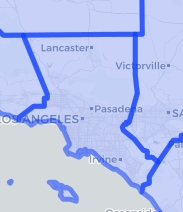
Wondering how the boundary of Los Angeles County looked like in 1851? Here you go:

Here it is in 1887, just before Orange County was created the year after:
The Atlas of Historical County Boundaries allows you to explore how county boundaries have shifted throughout history. You can also download GIS shapefiles of polygons for each different configuration of a state’s counties or the entire United States, coded by date. Check it out!
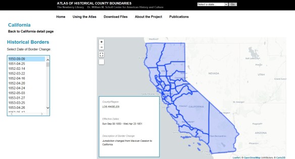

I like it…one thing I noticed though, on the interactive viewer it only goes to 2000. So, of course, in 2002 there was a boundary change between Los Angeles and Kern counties. That info is here: http://dpw.lacounty.gov/sur/nas/SMPM_AnnexationCity/ZLA002.pdf
So great historical info (which was the point of this)…but not the current boundary (in case anyone didn’t see that note).
Looks like in their “About the Project” page it states “documenting boundary changes in all 50 states in June 2010”. I guess they might have missed some.
They qualified it in the notes; for California it states through 2000 only. Maybe that’s all they got to in our beautiful state. Still very cool!